Sunday, 10 August 2014

Viking Cruise 2014 - Day 8

Gothenburg to Utkaften

11th June 2014
Light winds W 2/3 Poor visibility 5 miles
Distance travelled 24.9 nm


I departed in company with Damson a Drifter heading northward in the direction of Marstrand.. We first sailed west down the main channel into Gothenburg. The channel was marked with large cantilever markers which I have not seen before. We motored into the slight westerly breeze and passed jettys and other harbour traffic. We were passed by a fast Police rib with four officers one of which was only dressed in shirt sleeves. I could only imagine that there was some type of emergency on one of the outlying islands. It certainly looked very impressive.

Main channel into Gothenburg with river traffic.

Off Lying islands with still plenty of depth of water
 Turned north towards the island of Bjorko and able to set sail and make 2 or 3 knots. Passed the car ferry to the outlying islands and continued past settlements on both sides of the sound.


Lunch stop on Bjorko

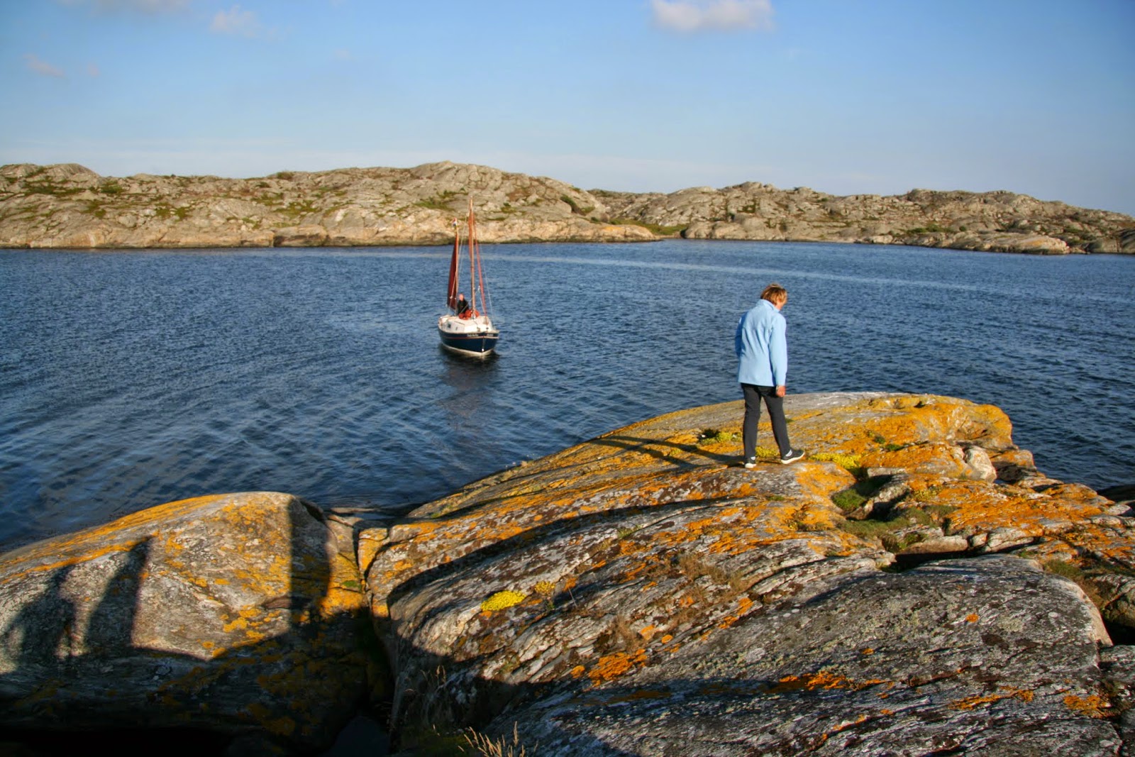
 At about 12:00 hours we stopped for lunch at a concrete jetty adjacent to large ice eroded rocks. This was how I imagined sailing in the Swedish archipelago would be.   

Looking north from the lunch stop.


Bovik

Passage between Bovik and Angh island
 After lunch we motored through the passageway at Bovik and into a wider sea dotted with islands.

Mavh

A nice slot.
 I improved my windward performance by moving the jib sheet  fairlead to the rear of the slide to flatten the foresail and to stop the sail from backing the main.

Leskskar bak

Leskskar bak
 we arrived at our anchorage of Utkaften which is on the southern end of Marstrand island. This was the preferred anchorage in the cruising guides for the Marstrand area. Mooring was by using the mooring bolts on the rocks and the laying of a kedge anchor to keep the boat off the rocks. It was possible to moor the boat within feet of the rocks and step on to the shore. With the minimal tidal range it was possible to stay all night on these moorings. There were basic facilities on shore of rubbish disposal and composting toilets. These are provided by the local commune to keep these remote anchorage clean and tidy.


Composting toilets complete with nautical decoration and toilet paper.
The walk to the toilets was not easy negotiating the fractured
 and steep rocks. There was also a narrow plank bridge to walk.


Our three Dutch boats who had fallen behind with the rudder breakage had eventually caught up with the fleet and we were reunited with them at Utkaften.


Saturday, 9 August 2014

Viking Cruise 2014 - Day 7

Vassingso to Gothenburg

10th June 2014

Light winds NE 1/2. Visibility good, Sunshine
Distance sailed 23nm 


Awoke to a fine morning with a slight mist across the fjord and took some atmospheric shots of Appuski too and the fjord. I breakfasted and got the boat ready for sea and seeing that Tra Bhui was making ready and damson had already left I decided to leave for Gotthenburg.at about 0700 hours. there was little wind and so motored into the light NW wind.
At 07:55 hours I passed on the port side Hallands Svatsker light and continued on a northerly course. Tra Bhui was some way ahead and so I was sailing alone in this increasingly Swedish scenery of flat ice weathered rocks. At 09:15 hours passed Kungen island with seals sleeping in the morning sunshine. Also saw Eider duck, Canada geese with goslings, Cormorants and shags.
I was taking the inshore route to Gothenburg through Askimsfjord leaving large islands to port. It was still possible to see the main channel into Gothenburg with a number of larger cargo ships and passenger ships. In the inshore passage there was no traffic at all. There were occasional buoys but in the main I referred to the chart on my Navionics tablet app to find the best route through the increasingly dense pack of rocky islands. There always seemed to be an adequate of depth of water underneath the keel.
Arrived at the Royal Gothenburg Yacht Club at 12:15hours  and moored up bow to with the help of Ian from Damson. Scandinavian marina pontoons are not well equipped with places to attach mooring ropes. There is not a single cleat in the whole of the marina let alone a few mooring rings. The main method seems to be to tie your lines around the wooden structure of the pontoon walkways. The facilities were good with excellent communal showers and sauna. There were no cubicles and reminded of either public school or a rugby club.
Shops were a short distance away and one stop on the tramway. I decided not to go into Gothenburg but spent time walking along the sea front and admiring the expensive houses and the waterside bars and restaurants.


Eider Duck


Friday, 8 August 2014

Viking Cruise 2014 - Day 6

Varberg to Vassingso anchorage 

9th June 2014

Light NW wind Force 3/4
Visibility good.
Distance sailed 16nm


This was the first day that we had the wind from the north. we left Varberg at about 10:00 hours  The point of sailing was a port tack to windward and I found that I was not sailing as efficiently to windward as the rest of the fleet. I quickly fell behind the rest of the fleet and as a result I resorted to using the engine. The citadel at Varberg took a long time to go out of sight. I was sailing on my own and out of sight of the rest of the fleet.

In the afternoon I sailed northwards by tacking within sight of a large nuclear power station Ringhals which again took a longer than I expected to sail past.
Ringhals power station.

At 18:30 hours I again started the engine to make some progress against increasing NW wind. I motored the final 6 miles Vassingso anchorage. where I met the rest of the fleet at 19:30 hours. I was grateful for a hot meal cooked by the crew of Windroos.

Drascombe fleet on my arrival in the fjord

  Later in the evening the raft of boats split up and we anchored separately in the Fjord for a quiet night at anchorage. I watched a colourful sunset and quickly retreated into the cabin when the mosquitoes came out to bite.

Drifter 22 Appuski too
Sunset


An increasingly rocky coastline.


Thursday, 7 August 2014

Viking Cruise 2014 - Day 5

Falkenburg to Varberg

8th June 2014

Light SW wind F1/2
Clear visibility, Sunshine with occasional cloud.
Distance travelled 16.4 nm Average speed of 3 kts


Left Falkenburg at about 09:30 hours and made a maximum of 4 knots but averaged 2 knots or less. It was proving difficult conditions to maintain a decent cruising speed and so resorted to engine to maintain progress. I seemed to be one of the slower boats in the fleet. This may have been due to the efficiency and condition of the sails. The weight of the boat due to the amount of kit I was carrying, food and water. For a while I goose winged the sails by poling out the foresail with a whisker pole.
Arrived at Varberg at 15:20 hours.

Tyboat with unconventional Drascombe sail. 


Varberg citadel
 Varberg is the capital of Halland county and is well known for it's sandy beaches. The coastline changes at this point and becomes more rocky and continues all the way to the North Cape in Norway.


The Swedes have a great love of  large american cars.
 On our trip we saw a lot of american cars which were paraded around the streets "cruisin". This particular busy as it was prom night for the local high schools with graduating students parading through the streets to their Prom night Ball. They were dressed in evening dresses and dinner jackets.


Varberg was a ferry port for a service to Denmark. The ferry would manoeuvre within feet of the marina pontoons. 
   

Tuesday, 5 August 2014

Viking Cruise 2014 - Day 4


Viking Cruise 2014 - Day 4


Torekov to Falkenburg

7th June 2014

Wind W4 Good visibility Sunshine
Sea state slight
Distance travelled 25.5 nm Average speed 3 kts


Departed at 09:45 hours in good conditions with a westerly breeze making is a nice beam reach. The trip was quite uneventful and used the Autohelm to relieve the boredom of being on the helm.

This part of the coast is low lying and the shore is gently shelving and so it is wise to keep well clear of the coast. The geography of this area is greatly influenced by the glaciers which covered Scandinavia in the Ice Age. This area was about the limit of the ice sheet and this area and a lot of Denmark is covered in glacial moraine hence the shallow Roskilde Fjord. As we move north the rocks become more exposed and there is clear evidence of ice erosion on the rocks. In Norway the fjords become deeper and more dramatic.


During the day the wind strength fell away to about F2 or 3 and our initial speed of 4/5 knots could not be maintained and dropped as low as 2 knots.

0850 Neighbour at Falkenburg.JPG
Copyright Douglas Hopwood

Arrived at 18:00 hours in Falkenburg is an industrial port with a lot of ship repair going on. The ships are raised out of the water on floating harbours. We berthed at the local sailing club on the south eastern side of the river. We later had a walk around the town where the cafe's and clubs were busy with the locals.

0860 Fleet moored in an industrial setting.JPG
Copyright Douglas Hopwood


Friday, 1 August 2014

Viking Cruise 2014 - Day 3

Viking Cruise 2014 - Day 3

Gilleleje to Torekow, Sweden
6th June 2014

Wind SE4 increasing Overcast 
Sea state 1 metre wave height.
Distance sailed 22.3 nm Average speed 2.9 kts


This leg of the cruise was the one I had the most concerns. It was an open sea with few ports of refuge. The SE wind had a long fetch through the Sound. A shipping lane with obvious dangers for small craft, being seen etc.
In light of experience from the previous day I made more preparations for a long cruise. Prepared sandwiches and had other munchies and drink to hand. Donned waterproofs believing that it is easier to take them off rather than trying to put them on underway. Put a reef in the mainsail, again easier to do in port than under way,
Left Gilleleje at 09:45 hours and because of a lack of wind shook out the reef in the mainsail. The initial feeling were that this was going to be relatively easy passage but the weather did look unpredictable.
At 6 miles out the wind speed increased and the wave height increased. the boats motion was particularly uncomfortable with the sea on the starboard quarter. The boat speed was averaging about 5 to 6 knots and I was becoming concerned that we might broach. My fears were confirmed when a gust and wave heeled the boat over to the port pushing the gunwale under. A large bucketful of water slopped down into the cockpit well. I was quickly able to right the boat and resume my course.
I was relatively happy continuing my course but needed to reduce sail and so therefore there was nothing for it but to head into the wind and put a reef into the mainsail. I dropped the main to my one and only reefing point and clipped the mainsheet to the reefing point and keeping the mainsheet tackle attached to the clew. I did not feel tying the 6 or 7 reefing points and so I continued sailing with the bottom flapping like a duvet cover. It may not have been pretty or seamanlike but I was confident that it was safe and I had effectively reduced the sail area. The photograph below was taken after we had rounded Kullen point and the sea state had reduced or is it the case that one's memories of that day have already changed.

 0800 Windy day.JPG

The reduced sail certainly made the boat more manageable but the speed had not reduced much below 5 knots. I rounded Kullen point at about 13:30 hours. In the lee of the point the sea state improved and the wind reduced. I was able to tidy up the reefed mainsail and make it look a bit more seamanlike. I was also able to grab something to eat and drink. I put the Autohelm on for the first time.to give me a rest.
Continued on passage bound for an anchorage on Hallands Vadero an island off the coast close to the port of Torekov. The sea state and wind increased again and arrived at Torekov at 15:30 hours. There were a number of the fleet who wanted to continue on but I had had enough as I had been sailing single handed for about 6 hours in what I considered quite rough conditions.
There had been one Drifter 22 not make the destination due to a broken rudder. He had made for Molle on the Kullen peninsula with 2 coasters who had stayed with him for support. He had made this refuge by steering with his outboard.

I was congratulated later for completing the passage as the only single crewed Coaster the smallest type of boat in the fleet. 
Torekov is an old fishing village but is now mostly occupied as second homes by wealthy swedes from Malmo and Gothenburg. All the houses are in excellent condition and as throughout scandinavia great pride is placed in flying their national flag from their properties. I took an early morning walk and found a few of the locals taking an early morning dip in the sea from purpose made bathing platforms. You would see people dressed in fluffy white dressing gowns making their way to the beach on bicycle.


Local legend that a Danish  Queen wished to murder her step children and so she organised a sea journey in a leaky and unseaworthy ship. The ship was wrecked close to Torekov and one of the  children was washed ashore and were found by the large rock in the picture above.According to an old legend, the town is named after the girl later known as Saint Thora, found on the shore of Torekov. the other two children were washed ashore at Gilleleje and Arilda. However, the more prosaic explanation refers to two old words thora meaning height, and kove meaning cabin or hut.


The Hallands Vadro island nature reserve is a local tourist attraction with daily ferry trips to the island. The island contains some of the oldest oaks in Sweden and was once the hunting grounds of Danish Kings..The island was permanently occupied but there are only the remaining houses rented out as holiday lets.

According to one of the local yachtsmen we had travelled the most difficult part of the voyage crossing from Denmark and around the Kullen peninsula. The rest of the journey to Oslo would be more straightforward.